Our City
Weißenstadt city is located in the eastern part of the administrative district of Upper Franconia in Wunsiedel county. It is part of planning region 5 (eastern Upper Franconia).
The district (42.21 km²) is home to 3,095 citizens (as of June 2023), who are spread across 21 municipalities. Weißenstadt itself contains 75% of that population.
Historical development
| 1299 | First documented mention. |
|---|---|
| 1348 | Weißenstadt is ruled by burgrave of Nuremberg, who later became margrave of Ansbach-Bayreuth. |
| 1410 | City lake is dammed up. |
| 1429 | Destruction by Hussits. |
| 1462 | Destruction by Bohemia. |
| 1529 | Reformation. |
| 1618–1648 | Thirty Years’ War. |
| 1787 | Installment of an imperial post office |
| 1791 | The margravate of Ansbach-Bayreuth arrives in Prussia |
| 1806–1810 | French occupation |
| 1810 | The former margravate arrives in Bavaria. |
| 1812 | The city lake is drained. |
| 1823 | Great fire swept through the city. |
| 1899 | Opening of the Kirchenlamitz-Weißenstadt railway. |
| 1929 | Establishment of the public pool. |
| 1976 | Flooding of the restored Weißenstadt Lake. |
| 1978 | During the process of reforming the government, new municipalities are added to Weißenstadt: Franconia, Voitsumra, Frohnlohe and Grub. |
| 1986 | Renewal of the old town begins. |
| 1991–1994 | A spa park is created to serve as a link between the lake and the city. |
| 2007 | Opening of the health resort “Kurzentrum” by the lake. |
| 2009 | The spring supplying the health resort with water containing radon is awarded the title of medicinal spring. |
| 2016 | The renewed and much improved mine Zinnererzgrube Werra is now open for visitors. |
| 2016 | Opening of the Siebenquelll® GesundZeitResort. A ****S‑Hotel including therapy- and spa-areas, a gym & a public pool as well as a sauna. |
History
Charlemagne himself used the military road leading through Fichtelgebirge when he was moving against Bohemia. It is safe to assume that people were living in the area even before the great settlement expansion of Giengen-Vohburgs, around 1050, brought Bavarian settlers to the area. Because of the local franconian accent, it is speculated that settlers must have come from the west as well.
A document from 1299 calls the area „Circa Albam Ecclesiam“, which roughly translates to „the village around the white church“. This is how the name „Weißenkirchen“ came to be (white=weiß, church=kirche).Weißenstadt or Weißenkirchen was part of the Waldsassen monastery in 1133. Later, up until 1347, the “Amt Rudolfstein mit Weißenkirchen” (office of Rudolfstein including Weißenkirchen) belonged to the Lords of Hirschberg who lived atop Rudolfstein. In 1348 the Hohenzollern burgrave of Nuremberg bought the area and elevated Weißenkirchen from village to city. They were the ones to set up one of the six offices in the city, that used to manage the area that is now Wunsiedel. The Hohenzollern remained as margraves of Ansbach-Bayreuth until 1791. When their line ended the land was passed on to the Prussian line of succession. When the French occupation (1806–1810) ended the area officially belonged to Bavaria.
Weißenstadt prospered in the Middle Ages due to tin-mining and wild wood beekeeping. Special tin and wild bee courts that served all Fichtelgebirge were seated in the city. As time went on, hand weaving and nail smithing grew to be important occupations in the area.
During times of peace, the trade route Nuremberg-Eger greatly supported and promoted trades, but proved to be a terrible disadvantage during wars. In 1429 the hussits destroyed the city. But there were many more march throughs, occupations and pillages during the Thirty Years’ War.
Because the railway Kirchenlamitz-Ost/Weißenstadt connected to the Hof-Marktredwitz route, the industrialization of Weißenstadt was accelerated. Because nailsmithes were economically replaced by steel- and iron wire industries, the granite industry grew instead. The most important stone processing plant is the GRASYMA (granite — syenite — marble). Hand-weaving was quickly substituted by mechanical weaving mills. The industrialization led to a rediscovery and thereby intense use of the forest as a source of resources. Factories for industrial wood processing, excelsior and excelsior spinning arose, while barely any basic wood processing was done in the area. Since the demand for machines skyrocketed, machine factories started emerging and supplying them locally. At the end of the 19th and beginning of the 20th century, Weißenstadts local economy was temporarily boosted by this development.The granite processing plants Kleemann and Ackermann (now GRASYMA), the weaving mill Spiegel and Ruckdäschel, the porcelain factories Dürrbeck and Ruckdäschel, a brick factory, an excelsior plant, a lumber mill, a steel wire factory, a hammer mill, a window factory and a tin- and uranium mine were the basis of the Weißenstadt economy. Despite this economic revival, the city could never emulate its former wealth.
Apart from the production industry, tourism was soon discovered as a source of income. Once the railway was completed, Weißenstadt grew more and more popular as a holiday resort for its saxon neighbors. In 1929, the biggest public pool in the whole area was opened, the Bayersweiher was prepared for boats and a ski jumping hill was built. The war and its devastating aftermath (but especially the construction of the wall) stopped the further expansion of the tourism sector.
Only during the 70s the potential of that branch was rediscovered, which led to the lake being restored once more. The former Grasyma premises were turned into a resort. Some parts of the buildings remain in their original state and now serve as a backdrop for various events. With the opening of the resort right by the Weißenstadt lake in 2007 began the expansion towards medical tourism.
The entire historical center of Weißenstadt was put under protection for historical monuments. Because the citizens want to pass the unique barns and rock cellars on to future generations, they decided on urban rehabilitation.
Agriculture
51.6% of the land, which totals 2176 ha, is currently used for farming.
While in 1971, Weißenstadt had 157 agricultural operations, the number steadily fell to 65 back in 1997, effectively cutting the number in half.
Today, 28 agricultural operations use a surface area of more than 3 ha.
The trend leads to big plot of land which facilitate a sensible management style. This, however, diminishes the variety of wildlife near close to nature structures.
Forestry
With a total surface area of 1451 ha, 34% of the urban area is covered by forests.
This is just slightly lower than the upper franconian average of 39%.
The main tree species is, like in the rest of the district, the spruce in fresh to peat soil areas.In areas with dryer soils pine trees are very common. The amount of fir trees in Fichtelgebirge has drastically decreased and there are only a few of them left. The conditions are very opportune for deciduous trees, here, however, their growth is insufficient for forestry. The occurrence of beech atop Buchberg, east of Weißenstadt is especially opportune. The forests in the western parts from Ruppertsgrün to Torfmoormühle are, according to the function plan of the woods, are areas especially important for the water supply of the public. Apart from that he forests are also perfect for recreation. Vast parts of the woods are officially recreational forest. The emergence of a mixed forest would be especially beneficial for the environment as well as helpful for recreational purposes.
Transport Connection
Neither highways nor interstates lead directly through Weißenstadt.
The nearest motorway access to the A9 is about 15km (9.3 miles) away, near Gefrees/ Münchberg. The nearest motorway access to the A93 Regensburg-Weiden-Hof is about 15km (9.3 miles) away, near Thiersheim. State road 2180, going from west to east, leads directly through Weißenstadt and connects the two highways. The state road is now where an ancient trading route used to lead from Frankfurt to Prague.
Altitude
Weißenstadt is located about 630 meters above sea level. The rolling countryside is traversed by floodplains, rivers and streams. The horse-shoe-shaped ridge of the Fichtelgebirgsmassiv around the plateau reaches altitudes of up to 1000 meters above sea level.
Altitude of the city center of Weißenstadt: 612–630 meters above sea level
Landscape
The many hills and valleys that are home to the rivers Eger (west- east) and Birkenbach (north — south) are a characteristic feature of the area.
The plants by the riverside thread through the area like a green ribbon.
Weißenstadt lake, which has a size of about 50 ha and which is clearly visible from all directions, stands out among the otherwise rather unstructured farmland.
The farmland on the elevated areas and the meadows in the dips clearly mark a very rural and rustic area. Small settlings and farms emphasize the importance of farming. Most of the villages are located on the hillside, especially in the areas that offer access to wellsprings. A mosaic of meadows, woods and ponds form the area north of Weißenstadt lake. The area appears much more lively than the repetitive farmlands to the west and north-east of the lake. Towards the edges in the north and south, the terrain rises up and is covered mostly with dense woods.
Rudolphsteins listed summit sticks out with an altitude of 866m. This creates the impression that Weißenstadt is located in a dip, protected in all directions by mountain ranges. Especially where the forest area begins, some lovely panoramas can be found, overlooking the whole area. The rough elevated forest areas form a stark contrast to the soft meadows and hills closer to the municipal district.
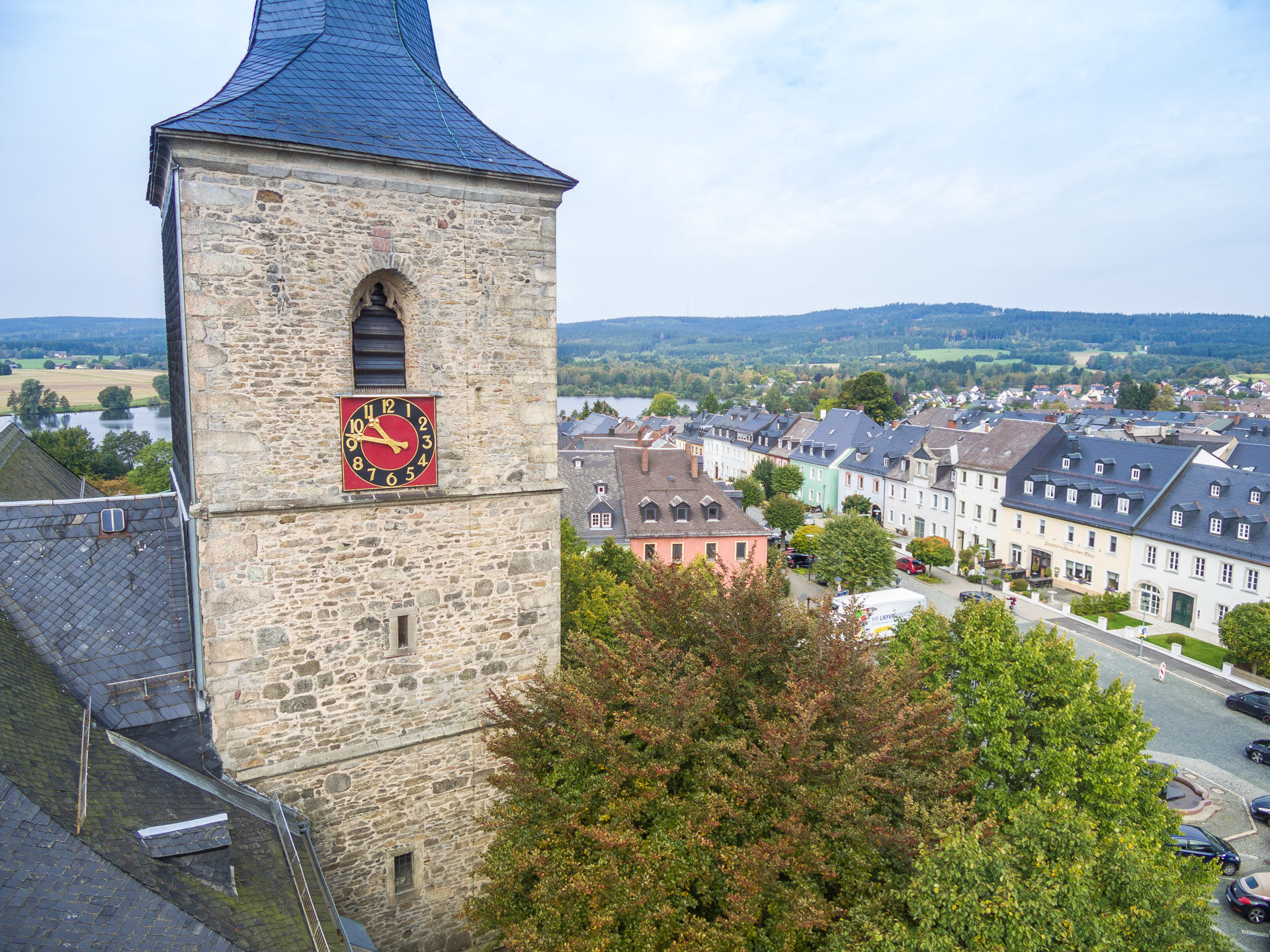
The historical center of Weißenstadt can be spotted from the hilltops to the north and south (Hexenstein) of the city center. The listed rock cellars, of which about 200 still exist all over the city, and the barns on the edge of town add to the unique character of Weißenstadt.
Wildlife
The bird life near Weißenstadt is especially diverse. The close proximity of dry and moist, warm and brisk areas plays a big part in this. The white stork breeding pair of Weißenstadt is of great nationwide significance. Their horst is located atop a chimney near the outskirts of town. Since the neighboring wet meadow of the Egeraue offers food to the storks, it is imperative that the area be maintained in order to make survival easier for the storks.
Geology
The geological landscape in Weißenstadt is, like in most parts of the Fichtelgebirge, dominated by granite. A broad stripe of porphyry granite coming from the Weißenstadt-Markleuthner-Massivs runs from the southwestern to the northeastern parts of the area. A thin stripe of shist connects to the granite towards the north. A wider stripe of muscovite-like stone grazes the municipal district in the north. The Weißenhaid area contains porphyry gneiss, which is contained within shist.
Down the Schneeberg towards Franconia, pewter granite can be found. The stone changes to hornfels the closer you get to Franconia. The southeastern regions around Meierhof are mostly feature orthogneiss. The hills are covered in diluvial solifluction soils and solifluction clays. The valleys contain quaternary valley sediments such as sand, gravel, alluvial loam or clay.