

The finest mountains around Bad Weißenstadt am See: Schneeberg, Waldstein, Rudolfstein, Nußhardt and Haberstein.
The Schneeberg

At 1,051 m above sea level, it is the highest mountain in the Fichtel Mountains and in all of Franconia. The summit area lies in the district of Wunsiedel im Fichtelgebirge, bordered to the west by the district of Bayreuth. Its extensive forests are managed by the Bavarian State Forests (Bayerische Staatsforsten), specifically the Selb forestry office. The bulky tower, visible from far and wide, is a reminder of the Cold War and today also serves as a memorial to peace. The summit consists of a sea of granite boulders and a rock formation topped by the small lookout tower known as the “Backöfele” (“little bread oven”).
The summit area is a nature reserve, but it “suffered” badly during the Third Reich and, after the end of the war, was almost completely destroyed by military installations. On 29 December 1995, on the initiative of District Administrator Dr Peter Seißer, the district of Wunsiedel im Fichtelgebirge acquired a 6,500 m² plot in the former American restricted area, which also includes the “Backöfele”. Demolition and renaturation work was then carried out in cooperation with the Fichtelgebirge Nature Park.
The Rudolfstein


Rudolfstein Archaeological Monument
One archaeological monument is known within the town of Weißenstadt: the castle site of Rudolfstein, about 3 km south-south-west of Weißenstadt.
This wooded mountain (866 m above sea level) in the north-eastern part of the Schneeberg massif, south of Weißenstadt, lies on the Höhenweg ridge trail. Its summit area has several curiously layered rock formations, which are a protected natural monument. Since 1890 a staircase has led up the highest rock tower, from where you can enjoy a wonderful view of the Weißenstädter See lake.
Count Palatine Rudolf of the Nordgau, after whom the mountain is named, is said to have built the first fortification here in 857, although this cannot be proven by documents. Tin and uranium were once mined extensively on the northern slope. The first documented mention of a castle dates from 1317, when Count Berthold of Henneberg received the castle and its associated villages, including Weißenkirchen (now Weißenstadt), as an imperial fief. He in turn enfeoffed the brothers Heinrich, Friedrich, Arnold, Eberhard and Haymann von Hirschberg with the estates. The Hirschbergs got carried away and raided the neighbouring lands of Waldsassen Abbey, whereupon the castle is said to have been stormed and destroyed. On 22 January 1333 the Hirschbergs declared that their estates had been returned to them and that they were officials of Rudolfstein and Weißenstadt. In 1347 the Burgraves of Nuremberg acquired the Rudolfstein and its estates. When the castle was actually destroyed cannot be established with certainty; after 1485 it no longer appears in the records. In 1703, during the War of the Spanish Succession, when the Margrave of Bayreuth marched with the Emperor against Bavaria, a watch post with a beacon fire was set up on the Rudolfstein.
Thanks to its deciduous trees, the Rudolfstein is a popular hiking destination in spring and autumn. Hikes start from Weißenstadt (trail marked “H”) or from the villages of Meierhof or Schönlind (blue-dot trail).
“Drei Brüder” Rock Towers Geotope
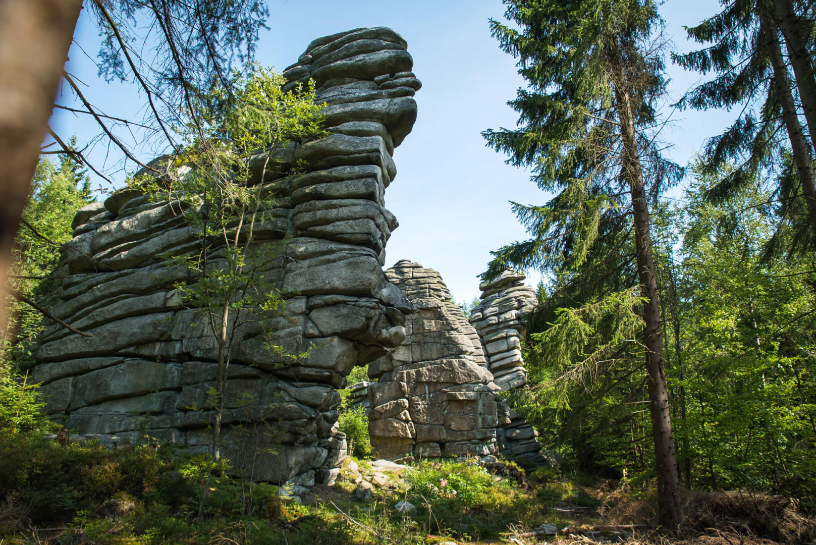
Weißenstadt is particularly proud of the “Drei Brüder” (Three Brothers) rocks on the Rudolfstein, which rank among the finest geotopes in Bavaria. The Rudolfstein is also known as the “Matratzenlager” (“stack of mattresses”), because that is exactly what its rock formation looks like. The three closely spaced rock towers south-west of the Rudolfstein form an impressive group of granite that was formed around 285 million years ago. At that time, towards the end of the Palaeozoic era, several continental plates collided in the area of present-day Central and Western Europe.
This led to the formation of the Variscan mountain range. In the process, some of the rocks – sediments and volcanic rocks from the former continental margins and the ocean basin between them – were pushed down to great depths. Under the pressures and temperatures there, they were transformed and partly melted. The resulting molten rock rose through weak zones in the Earth’s crust, but often did not reach the surface, solidifying instead several kilometres down as what are known as intrusive rocks. The granites of the Fichtel Mountains are a typical example. Over many millions of years the Fichtel Mountains were uplifted, and weathering and erosion exposed the deeper layers of rock. This is why granites that formed deep in the Earth’s crust can be found at the surface today.
Schwesternsteine
Massive rock formations west of the Höhenweg trail between the Rudolfsattel saddle and the Rudolfstein. Their name, “Sister Stones”, comes from their location close to the Drei Brüder (Three Brothers).
The Großer Waldstein
The Waldstein (877 m above sea level) is one of the mountains in the northern arm of the Fichtel Mountains horseshoe. The summit area is covered in mixed forest with old beech trees and massive rock towers; the entire area is a nature reserve (20.2 ha). Waymarked trails lead to the mountain from all directions. Public roads run from Weißenstadt or Sparneck right up to the summit area, where you will find the mountain hut of the Fichtelgebirgsverein (Fichtel Mountains Club), the Waldsteinhaus.
From here you can take a walk through the fascinating summit area. The Schüssel (“bowl”), a basin-like hollow on the highest rock of the Waldstein, which the steps now lead up to, once gave the rock its name. The name was later passed on to the lookout pavilion, built in 1851 by the local forester because King Maximilian II of Bavaria had announced a visit – although, short of time, he never made it up the Waldstein.


Rotes Schloss Castle Ruins
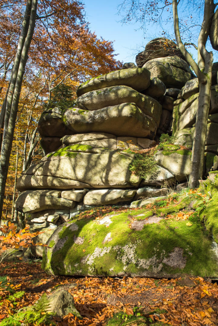
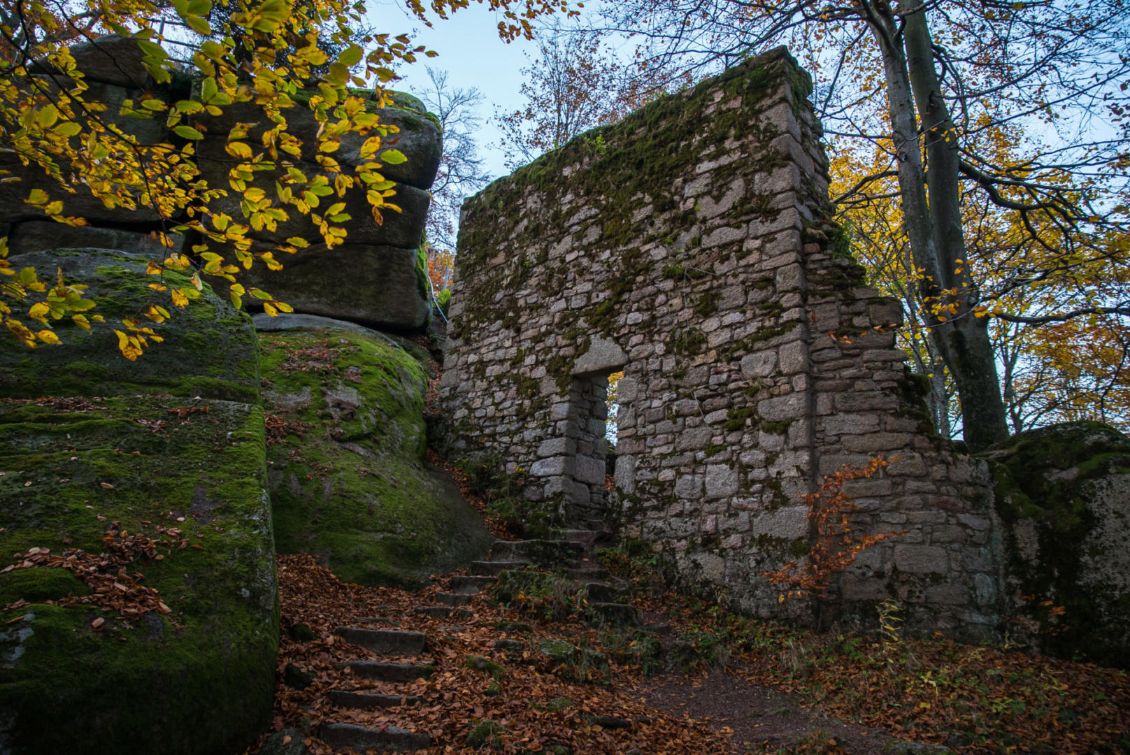
Opposite the Waldsteinhaus to the east rises a massive rock face bearing the remains of the curtain walls of the former main castle, the “Rotes Schloss” (Red Castle), so called because of its tiled roof at the time. Through the castle gate, stone steps lead into the inner courtyard, which once held several buildings (gatehouse, residential tower, cistern). The castle was built in the 14th century by the Lords of Sparneck and destroyed by the Swabian League in high summer 1523.


Teufelstisch (Devil’s Table)
In front of the castle gate stands a massive block of rock that widens towards the top, crowned by an oval slab: the legendary Teufelstisch. According to legend, this is where the devils play(ed) their wild games of cards.

Former East Castle
Before the climb up to the Schüssel lookout pavilion are the remains of the walls of a late Romanesque chapel (see picture) that belonged to the East Castle (Ostburg). At the north-eastern foot of the Schüssel rock are the remains of the walls of the East Castle itself, which was built around 1100 and abandoned around 1300 when the main castle was built. Excavations also uncovered several Stone Age microblades, scrapers and fragments of perforated pendants made of Jurassic chert, which does not occur in the Fichtel Mountains. It is therefore assumed that the Waldstein summit was a Stone Age camp site. Pottery shards and metal objects that came to light also show that fortifications must have existed here between the 8th and 10th centuries. A massive rock colossus resting on two stacked rock slabs, known as the Waagstein, lies 200 m to the east.
Bärenfang (Bear Trap)

200 m west of the Waldsteinhaus stands the Bärenfang, first mentioned in records on 3 April 1656. The building, made of granite blocks, served as a trap for predators after they had multiplied out of control in the Fichtel Mountains during the Thirty Years’ War. A bear lured inside by bait would trigger the iron grille to drop; once caught, it had to be delivered alive to the Margrave of Bayreuth.
Seehügel and the Seehaus

This mountain in the Schneeberg massif rises to 953 m above sea level. In 1492 it was called Farmleitten, later Farenleutten, Farleite, Farnleiten and Hohe Farrenleithen – names that usually referred to the whole south-western slope and mean something like “searching” or “stalking” on a hillside. The name Seeberg, the mountain above the Fichtelsee lake, first appears in 1799. Tin was mined on the western slope down to today’s B 303 main road from early on, from 1757 in the “Glückauf” and “Friedrich-Carls-Glück” tin placer works, with interruptions until 1827. In 1762 the first miners’ house was built; the Seehaus mountain hut of the Fichtelgebirgsverein (FGV) now stands in its place.
The Nußhardt

It is the most distinctive rocky summit in the Fichtel Mountains (core granite and gneiss) and a nature reserve (5.5 ha). On the lookout rock there are eight small, bowl-shaped hollows in the granite: druid bowls! Our ancestors believed they were sacrificial bowls used in pagan rituals. Today we know that they are a special form of weathering in granite. Before climbing to the top, be sure to visit the “Nußhardtstube”, a boulder cave about 50 m long formed by weathering. Nusser, Nosser, Nußhardt – who can explain the name? As early as 1880, the Fichtelgebirge section of the German and Austrian Alpine Club built the first steps up to the highest point of the Nußhardt rock (972 m above sea level) “for a better view” of the Schneeberg and Ochsenkopf, the Fichtelsee lake, the Franconian Jura and the Kemnath area. The Nußhardt lies on the Höhenweg trail between the Seehaus and the Schneeberg.
The Haberstein
On a rise (927 m above sea level) on the south-western slope of the Schneeberg lies the largest continuous sea of granite boulders in the Fichtel Mountains, designated a nature reserve covering 12.9 ha. The strictly protected northern firmoss grows between the boulders. The Haberstein lies on the trail from Bischofsgrün to the Schneeberg and also delights visitors with its fine long-distance views.